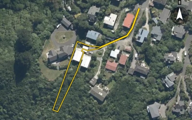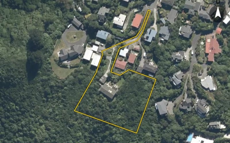
Estimate $931k – $1.18m
5
4 Pine Tree Lane, Korokoro

Pine Tree Lane in Korokoro has 8 properties, valued by the council between $760,000 and $1,150,000 with a median of $940,000 (Korokoro: $900,000). Most of its homes were built in the 1960s. We estimate its homes at a median $895,000. 1 sold in the last twelve months. The highest sale in 2026 was 4 Pine Tree Lane, at $980,000.
The council values Pine Tree Lane's 5 rated properties between $760,000 and $1,150,000. The middle half sit between about $826,000 and $1,057,000; the median is $940,000 and the mean $946,000.
| Bedrooms | Homes | Median council value | Sold, last 12 months | Median sale |
|---|---|---|---|---|
| 2 | 1 | $940k | 0 | — |
| 3 | 1 | $760k | 0 | — |
| 4 | 2 | $940k | 0 | — |
| 5+ | 1 | $1.15m | 1 | — |
Council rating valuations: the council's figure for apportioning rates, not a market appraisal.
Pine Tree Lane's median council value is 4% above Korokoro's.
| Pine Tree Lane | Korokoro | Lower Hutt | |
|---|---|---|---|
| Median council value | $940k | $900k | $790k |
| Sold in the last 12 months | 12.5% | 3% | 1.5% |
| Median section | 1,093 m² | 899 m² | 579 m² |
| Median year built | 1960 | 1960 | 1960 |
| Council value per m² of floor | $6k | $6k | $6k |
Pine Tree Lane has 6 houses and 2 units and townhouses. Most were built in the 1960s (80%).
Every street in Korokoro, and the suburb's house prices and sales.
Sales and valuations as at 11 September 2026, from council and LINZ records. Medians resting on fewer than 3 sales are not shown.
The real estate agents credited on Pine Tree Lane sales since 2016, most first. Selling here? These are the agents who have sold your neighbours' homes. A count of sales, not a rating. Every agent who sold in Korokoro.
 Shellene EksteenProfessionals Redcoats
4 sales on Pine Tree Lane since 2016; 2 of them name an agent we can show, and the counts here are taken from those.
Every property in Pine Tree Lane, Korokoro, whether it is for sale or not: homes, sections, farms, lifestyle blocks, shops, offices and industrial land. Each is listed from the council rating roll and Toitū Te Whenua LINZ, with the listing beside it when an agent is marketing it.
Each property has its own page: our estimate of its value beside the council rating valuation, past sale prices, the title and land area, zoning and hazards, building consents, and what it would cost to own.
Listings are published by the agents who market them. Addresses, land details and rating valuations come from Toitū Te Whenua Land Information New Zealand and from the council. No ownership information is published.
Header photo: Greater Wellington Regional Council, CC BY 4.0, via Wikimedia Commons (licence).