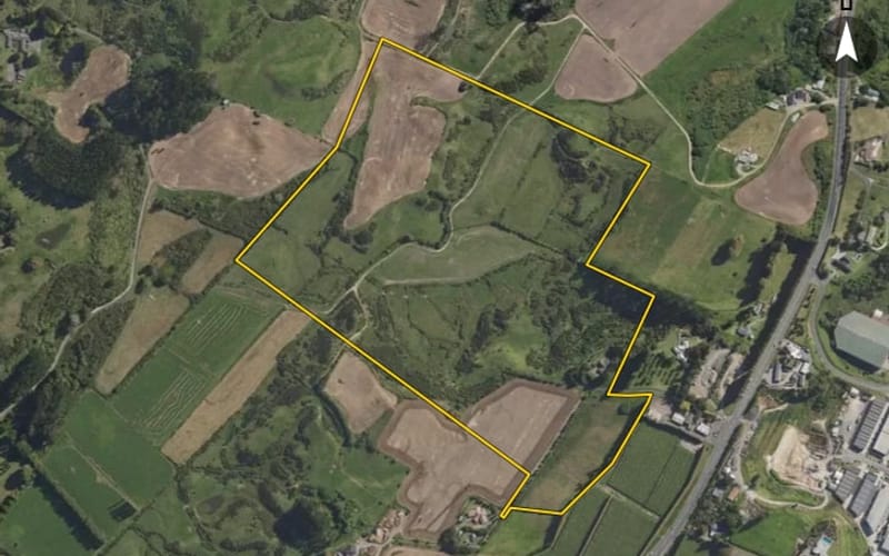
State Highway 29, Tauriko
State Highway 29 in Tauriko has 44 properties, valued by the council between $490,000 and $34,210,000 with a median of $1,010,000 (Tauriko: $1,820,000). More of its homes were built in the 1990s than in any other decade. We estimate its homes at a median $1,020,000. The last sale we have was in February 2025, for $765,000.
44 properties on State Highway 29, Tauriko
Highest and lowest on State Highway 29
Property values on State Highway 29
The council values State Highway 29's 31 rated properties between $490,000 and $34,210,000. The middle half sit between about $780,000 and $1,470,000; the median is $1,010,000 and the mean $2,707,097.
| Bedrooms | Homes | Median council value | Sold, last 12 months | Median sale |
|---|---|---|---|---|
| 2 | 1 | $770k | 0 | — |
| 3 | 11 | $760k | 0 | — |
| 4 | 13 | $1.43m | 0 | — |
| 5+ | 1 | $1.2m | 0 | — |
Council rating valuations: the council's figure for apportioning rates, not a market appraisal.
State Highway 29 compared with Tauriko
State Highway 29's median council value is 45% below Tauriko's.
| State Highway 29 | Tauriko | Tauranga | |
|---|---|---|---|
| Median council value | $1.01m | $1.82m | $865k |
| Median section | 3,187 m² | 4,000 m² | 670 m² |
| Median year built | 1975 | 1990 | 1990 |
| Council value per m² of floor | $7k | $7k | $6k |
State Highway 29 house prices over time
Median sale price by year; 2025 is the year so far. A year with fewer than two sales has no bar.
Sales by year as a table
| Year | Sales | Median price | Per m² floor |
|---|---|---|---|
| 2025 | 2 | $762,500 | $5,836 |
| 2024 | 1 | $650,000 | $5,118 |
| 2021 | 2 | $1,240,000 | $6,168 |
| 2020 | 3 | $465,000 | $3,370 |
| 2018 | 1 | $450,000 | — |
| 2017 | 2 | $375,000 | $3,208 |
| 2016 | 1 | $480,000 | $2,500 |
Recent sales on State Highway 29
- 1013 State Highway 29$765,00010 Feb 2025 · 3 bed · 100 m² floor · 1,464 m² land
- 859 State Highway 29$760,00028 Jan 2025 · 2 bed · 189 m² floor · 1,011 m² land
- 861 State Highway 29$650,00028 Sept 2024 · 3 bed · 127 m² floor · 644 m² land
- 741 State Highway 29$1,450,00029 Jan 2021 · 6 bed · 204 m² floor · 4,431 m² land
- 745D State Highway 29$1,030,00015 Jan 2021 · 4 bed · 197 m² floor · 1,694 m² land
- 757 State Highway 29$465,00010 Nov 2020 · 3 bed · 138 m² floor · 860 m² land
- 759 State Highway 29$695,00010 Nov 2020 · 3 bed · 100 m² floor · 1,209 m² land
- 763 State Highway 29$265,00010 Nov 2020 · 4 bed · 149 m² floor · 862 m² land
- 745-749 State Highway 29$450,00014 Feb 2018 · 2,066 m² land
- 745D State Highway 29$360,00013 Oct 2017 · 4 bed · 197 m² floor · 1,694 m² land
- 773 State Highway 29$390,00017 Jul 2017 · 3 bed · 85 m² floor · 8,094 m² land
- 999 State Highway 29$480,0001 Sept 2016 · 4 bed · 192 m² floor · 1.3 ha land
- 1013 State Highway 29$390,00023 Jul 2015 · 3 bed · 100 m² floor · 1,464 m² land
- 841-849 State Highway 29$530,00016 May 2014 · 4 bed · 248 m² floor · 1.25 ha land
- 953A State Highway 29$625,00016 Apr 2013 · 4 bed · 282 m² floor · 2.26 ha land
- 1013 State Highway 29$280,00019 Dec 2012 · 3 bed · 100 m² floor · 1,464 m² land
- 767 State Highway 29$375,00027 Nov 2012 · 4 bed · 190 m² floor · 862 m² land
- 861 State Highway 29$263,00016 May 2012 · 3 bed · 127 m² floor · 644 m² land
- 741 State Highway 29$468,00015 Mar 2012 · 6 bed · 204 m² floor · 4,431 m² land
- 696 State Highway 29$435,00027 Sept 2007 · 3 bed · 149 m² floor · 5,678 m² land
The homes on State Highway 29
State Highway 29 has 41 houses and 2 sections. More were built in the 1990s than in any other decade (19%).
Building and resource consents on State Highway 29
- 769 State Highway 291 Jan 2026 · Building consentInstallation of a freestanding metro wee rad leg replacement solid fuel heater.
- 759 State Highway 291 Jul 2024 · Building consentInstallation of pre molded fiberglass inground swimming
More streets in Tauriko
- Cambridge Road77
- Taurikura Drive52
- Westridge Drive47
- Miles Lane45
- Gargan Road40
- Paerangi Place40
- Whakakake Street37
- Poturi Street31
- River Oaks Drive29
- Westview Place25
- Whiore Avenue23
- Hotuhotu Street20
Every street in Tauriko, and the suburb's house prices and sales.
Sales and valuations as at 11 September 2026, from council and LINZ records. Medians resting on fewer than 3 sales are not shown.
Agents who sold on State Highway 29
The real estate agents credited on State Highway 29 sales since 2016, most first. Selling here? These are the agents who have sold your neighbours' homes. A count of sales, not a rating. Every agent who sold in Tauriko.
Jeremy PryorBower Real Estate BOP1 sale on State Highway 29 · last Apr 2026- 745D State Highway 29Apr 2026
- Trevor EastEast Realty1 sale on State Highway 29 · last Jan 2021
- 741 State Highway 29Jan 2021 · $1.45m
23 sales on State Highway 29 since 2016; 2 of them name an agent we can show, and the counts here are taken from those.
Every address on State Highway 29
44
- 694 State Highway 29
- 696 State Highway 29
- 741 State Highway 29
- 745-749 State Highway 29745B State Highway 29745C State Highway 29745D State Highway 29745E State Highway 29
- 751 State Highway 29
- 757 State Highway 29
- 759 State Highway 29
- 761 State Highway 29
- 763 State Highway 29
- 765 State Highway 29
- 767 State Highway 29
- 768 State Highway 29
- 769 State Highway 29
- 773 State Highway 29
- 776 State Highway 29
- 782 State Highway 29
- 808 State Highway 29
- 810 State Highway 29
- 815 State Highway 29
- 820 State Highway 29
- 841-849 State Highway 29841 State Highway 29
- 851 State Highway 29
- 855 State Highway 29
- 856 State Highway 29
- 859 State Highway 29
- 861 State Highway 29
- 865 State Highway 29
- 873 State Highway 29
- 878-880 State Highway 29878A State Highway 29878B State Highway 29878C State Highway 29878D State Highway 29
- 928 State Highway 29
- 953A State Highway 29953 State Highway 29
- 999 State Highway 29
- 1013 State Highway 29
- 1027 State Highway 29
About property on State Highway 29, Tauriko
Every property in State Highway 29, Tauriko, whether it is for sale or not: homes, sections, farms, lifestyle blocks, shops, offices and industrial land. Each is listed from the council rating roll and Toitū Te Whenua LINZ, with the listing beside it when an agent is marketing it.
Each property has its own page: our estimate of its value beside the council rating valuation, past sale prices, the title and land area, zoning and hazards, building consents, and what it would cost to own.
Listings are published by the agents who market them. Addresses, land details and rating valuations come from Toitū Te Whenua Land Information New Zealand and from the council. No ownership information is published.
Header photo: Koon Chakhatrakan on Unsplash (licence).